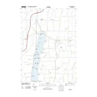
2010 Map of Livonia
USGS Topo · Published 2010About this map
Conesus Lake anchors this landscape, its shoreline dotted with residential clusters and landings that reflect a long history of lakeside life. The map details the transition from the concentrated village of Livonia to the recreational and seasonal settlements like Lakeville, Graywood, and Sleggs Landing. Inland, the terrain rises toward Jakman Hill and Henderson Hill, where the land use shifts toward larger rural parcels and a network of cemeteries—including Mount Pleasant Cemetery and Oak Ridge Cemetery—that document the generations of families who settled this part of Livingston County.
Find a feature on this map
92 named features on this map. Tap any name to fly to it.
Don’t see what you’re looking for? This feature index may not catch every label — zoom into the map to look around manually.
Map Details
Editions of this 2010 Livonia Map
This is the sole edition of this map. No revisions or reprints were ever made.
Other maps of this area

1901 · Honeoye
USGS Topo · 1:62,500

1902 · Wayland
USGS Topo · 1:62,500

1904 · Wayland
USGS Topo · 1:62,500

1904 · Caledonia
USGS Topo · 1:62,500

1904 · Honeoye
USGS Topo · 1:62,500

1905 · Nunda
USGS Topo · 1:62,500

1934 · Rush
USGS Topo · 1:24,000
1934 · Honeoye Falls
USGS Topo · 1:24,000

1942 · Springwater
USGS Topo · 1:31,680
1942 · Honeoye
USGS Topo · 1:31,680