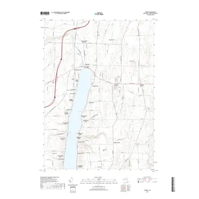
2019 Map of Livonia
USGS Topo · Published 2019About this map
Conesus Lake serves as the central focal point of this Livingston County landscape, its eastern and western shores lined with a dense network of residential landings and points. Distinct settlements like Lakeville at the northern tip and Livonia to the east define the local community structure, while smaller clusters such as Tuxedo Park, Graywood, and Sleggs Landing illustrate the intensive development of the lakefront.
Find a feature on this map
118 named features on this map. Tap any name to fly to it.
Don’t see what you’re looking for? This feature index may not catch every label — zoom into the map to look around manually.
Map Details
Editions of this 2019 Livonia Map
This is the sole edition of this map. No revisions or reprints were ever made.
Other maps of this area

1901 · Honeoye
USGS Topo · 1:62,500

1902 · Wayland
USGS Topo · 1:62,500

1904 · Wayland
USGS Topo · 1:62,500

1904 · Caledonia
USGS Topo · 1:62,500

1904 · Honeoye
USGS Topo · 1:62,500

1905 · Nunda
USGS Topo · 1:62,500

1934 · Rush
USGS Topo · 1:24,000
1934 · Honeoye Falls
USGS Topo · 1:24,000

1942 · Springwater
USGS Topo · 1:31,680
1942 · Honeoye
USGS Topo · 1:31,680