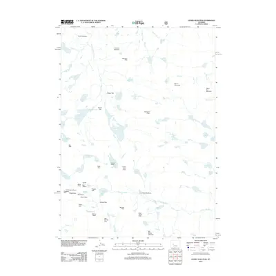
2012 Map of Lizard Head Peak
USGS Topo · Published 2012About this map
Lizard Head Peak and the high alpine terrain of the Wind River Range are captured in this 2012 survey, showcasing a landscape of granite summits and glacial features. The map details the iconic Cirque of the Towers, a dramatic semi-circle of jagged spires including Wolfs Head, Pingora Peak, and Watch Tower. These formations represent a significant mountaineering landmark, bordered by high-altitude passes like Jackass Pass and Texas Pass.
Find a feature on this map
74 named features on this map. Tap any name to fly to it.
Don’t see what you’re looking for? This feature index may not catch every label — zoom into the map to look around manually.
Map Details
Editions of this 2012 Lizard Head Peak Map
This is the sole edition of this map. No revisions or reprints were ever made.
Other maps of this area

1937 · Moccasin Lake
USGS Topo · 1:48,000

1938 · Mt Bonneville
USGS Topo · 1:62,500

1941 · Mt Bonneville
USGS Topo · 1:62,500

1942 · Mt Bonneville
USGS Topo · 1:62,500

1943 · Moccasin Lake
USGS Topo · 1:62,500

1953 · Sweetwater Gap
USGS Topo · 1:24,000

1955 · Lander
USGS Topo · 1:250,000

1958 · Lander
USGS Topo · 1:250,000

1961 · Lander
USGS Topo · 1:250,000
1969 · Big Sandy Opening
USGS Topo · 1:24,000