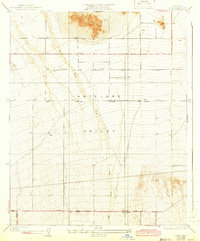
1934 Map of Llano
USGS Topo · Published 1943About this map
Lovejoy Buttes rise sharply above the floor of the Antelope Valley, dominating a landscape defined by alluvial drainage and early twentieth-century survey lines. The terrain is characterized by the broad, braided course of Big Rock Wash and other unnamed washes flowing north from the mountains toward the desert sink. Settlement is sparse, anchored by the Llano PO located along the Palmdale Victorville Road in the southern portion of the map.
Find a feature on this map
14 named features on this map. Tap any name to fly to it.
Don’t see what you’re looking for? This feature index may not catch every label — zoom into the map to look around manually.
Map Details
Editions of this 1934 Llano Map
4 editions found
Other maps of this area

1901 · Southern California Sheet No. 1
USGS Topo · 1:250,000

1903 · Rock Creek
USGS Topo · 1:62,500

1904 · Southern California Sheet No. 1
USGS Topo · 1:250,000

1930 · Lovejoy Springs
USGS Topo · 1:24,000

1930 · Black Butte
USGS Topo · 1:24,000

1930 · Little Rock
USGS Topo · 1:24,000

1930 · Llano
USGS Topo · 1:24,000

1930 · West Alpine Butte
USGS Topo · 1:24,000

1930 · Wilsona
USGS Topo · 1:24,000

1933 · Lovejoy Springs
USGS Topo · 1:24,000