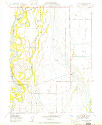
1950 Map of Llano Seco
USGS Topo · Published 1950About this map
Sacramento River meanders define the western edge of this 1950 survey, where the river's dynamic flow has shaped a landscape of islands and cut-off water bodies like The Lagoon and Hartley Island. Historically significant land grants dominate the interior, including the expansive Rancho de Farwell and the namesake Rancho Llano Seco. These agricultural lands are tied to the river by Parrott Landing and Hites Landing, which once served as vital points for commerce and transport.
Find a feature on this map
26 named features on this map. Tap any name to fly to it.
Don’t see what you’re looking for? This feature index may not catch every label — zoom into the map to look around manually.
Map Details
Editions of this 1950 Llano Seco Map
2 editions found
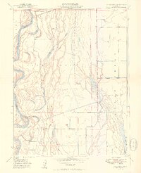
Other maps of this area

1888 · Marysville
USGS Topo · 1:125,000

1891 · Chico
USGS Topo · 1:125,000

1891 · Marysville
USGS Topo · 1:125,000

1893 · Chico
USGS Topo · 1:125,000

1894 · Marysville
USGS Topo · 1:125,000

1895 · Marysville
USGS Topo · 1:125,000

1895 · Chico
USGS Topo · 1:125,000

1906 · Maxwell
USGS Topo · 1:62,500

1906 · Willows
USGS Topo · 1:62,500

1911 · Landlow
USGS Topo · 1:31,680