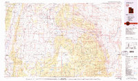
1980 Map of Loa
USGS Topo · Published 1980About this map
Rabbit Valley and the surrounding high plateaus form the heart of this 1980 survey, where the Fremont River carves its way through a sequence of dramatic geological features. The rural communities of Loa, Lyman, Bicknell, and Torrey anchor the agricultural corridor along Utah 24, while the eastern reaches of the map transition into the striking topography of Capitol Reef National Park. The survey illustrates a landscape of managed lands, from the timbered heights of the Fishlake National Forest to the unique drainage patterns of the Waterpocket Fold and Cathedral Valley. Notable water features include Otter Creek Reservoir and high-elevation bodies like Blind Lake on Boulder Mountain. This edition reveals the spatial relationship between the Awapa Plateau and the Aquarius Plateau, showing how isolation and topography influenced the settlement patterns of Wayne County and Piute County.
Find a feature on this map
116 named features on this map. Tap any name to fly to it.
Don’t see what you’re looking for? This feature index may not catch every label — zoom into the map to look around manually.
Map Details
Editions of this 1980 Loa Map
2 editions found
Other maps of this area

1885 · San Rafael
USGS Topo · 1:250,000

1885 · Beaver
USGS Topo · 1:250,000

1885 · Fish Lake
USGS Topo · 1:250,000

1886 · Kanab
USGS Topo · 1:250,000

1886 · Escalante
USGS Topo · 1:250,000

1886 · Henry Mountains
USGS Topo · 1:250,000

1892 · Henry Mountains
USGS Topo · 1:250,000

1896 · Fish Lake
USGS Topo · 1:250,000

1940 · Monroe
USGS Topo · 1:62,500

1944 · Monroe
USGS Topo · 1:62,500