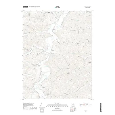
2019 Map of Load
USGS Topo · Published 2019About this map
Tygarts Creek winds through this deeply carved landscape in Greenup County, creating a central corridor for the local settlements of Lynn and Load. The terrain is defined by a dense network of hollows, including Hungry Hollow, Big Hollow, and the aptly named Haunted Hollow Rd. Historically, the area shows a clear pattern of small-scale agriculture and transit along the creek bottoms, while the surrounding ridges like Bays Ridge remained dominated by timber and steep topography.
Find a feature on this map
114 named features on this map. Tap any name to fly to it.
Don’t see what you’re looking for? This feature index may not catch every label — zoom into the map to look around manually.
Map Details
Editions of this 2019 Load Map
This is the sole edition of this map. No revisions or reprints were ever made.
Other maps of this area

1903 · Kenova
USGS Topo · 1:125,000

1904 · Kenova
USGS Topo · 1:125,000

1915 · Garrison
USGS Topo · 1:62,500

1918 · Garrison
USGS Topo · 1:62,500

1926 · Greenup
USGS Topo · 1:48,000

1930 · Greenup
USGS Topo · 1:62,500

1949 · Friendship
USGS Topo · 1:24,000

1949 · Brushart
USGS Topo · 1:24,000

1950 · Brushart
USGS Topo · 1:24,000

1950 · Tygarts Valley
USGS Topo · 1:24,000