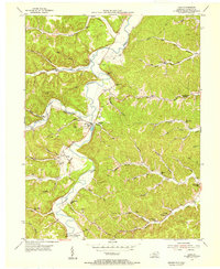
1953 Map of Load
USGS Topo · Published 1955About this map
Tygarts Creek meanders through a landscape defined by industrial extraction and small rural congregations during the early 1950s. The region is marked by numerous clay pits and a dedicated coal field, pointing to the underlying mineral wealth that sustained these communities. The presence of the Old Raccoon Furnace near Raccoon Creek serves as a reminder of the area's deeper iron-smelting history.
Find a feature on this map
75 named features on this map. Tap any name to fly to it.
Don’t see what you’re looking for? This feature index may not catch every label — zoom into the map to look around manually.
Map Details
Editions of this 1953 Load Map
2 editions found
Other maps of this area

1903 · Kenova
USGS Topo · 1:125,000

1904 · Kenova
USGS Topo · 1:125,000

1915 · Garrison
USGS Topo · 1:62,500

1918 · Garrison
USGS Topo · 1:62,500

1926 · Greenup
USGS Topo · 1:48,000

1930 · Greenup
USGS Topo · 1:62,500

1949 · Friendship
USGS Topo · 1:24,000

1949 · Brushart
USGS Topo · 1:24,000

1950 · Brushart
USGS Topo · 1:24,000

1950 · Tygarts Valley
USGS Topo · 1:24,000