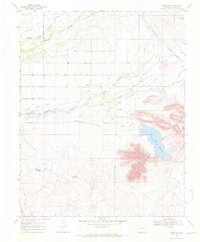
1967 Map of Lobatos
USGS Topo · Published 1971About this map
Lobatos and its surrounding high-desert agricultural landscape are defined by a complex network of man-made waterways during the mid-1960s. The settlement pattern follows the lifeblood of the Conejos River and Rio San Antonio, where an intricate system of irrigation ditches supports local ranching. Family and descriptive names appear throughout this system, including the Seledonio Valdez Ditch, Heads Mill Ditch, and Fuertecitos Ditch, illustrating how water rights and land use were partitioned.
Find a feature on this map
35 named features on this map. Tap any name to fly to it.
Don’t see what you’re looking for? This feature index may not catch every label — zoom into the map to look around manually.
Map Details
Editions of this 1967 Lobatos Map
3 editions found
Other maps of this area

1918 · Tusas
USGS Topo · 1:125,000

1922 · Conejos
USGS Topo · 1:125,000

1945 · Durango
USGS Topo · 1:250,000

1953 · Durango
USGS Topo · 1:250,000

1954 · Durango
USGS Topo · 1:250,000

1954 · Raton
USGS Topo · 1:250,000

1954 · Trinidad
USGS Topo · 1:250,000

1954 · Aztec
USGS Topo · 1:250,000

1955 · Trinidad
USGS Topo · 1:250,000

1958 · Raton
USGS Topo · 1:250,000