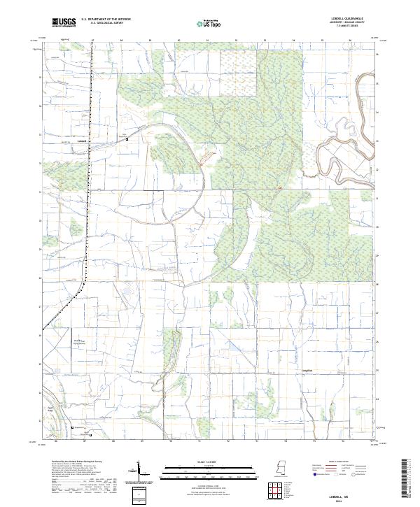
2024 Map of Lobdell
USGS Topo · Published 2024About this map
Lobdell and Longshot anchor this Bolivar County landscape, where the agricultural tradition of the Mississippi Delta meets the preserved wetlands of the Dahomey National Wildlife Refuge. The map reveals a complex hydraulic network essential to the region's history, characterized by winding watercourses such as Bogue Phalia, Good Luck Bayou, and Stillwater Bayou. These bayous and sloughs, including the aptly named Pistol Slough, dictate the placement of roads and fields in this alluvial plain.
Find a feature on this map
41 named features on this map. Tap any name to fly to it.
Don’t see what you’re looking for? This feature index may not catch every label — zoom into the map to look around manually.
Map Details
Editions of this 2024 Lobdell Map
This is the sole edition of this map. No revisions or reprints were ever made.
Other maps of this area

1933 · Lamont
USGS Topo · 1:62,500

1939 · Pace
USGS Topo · 1:62,500

1939 · Big Island
USGS Topo · 1:62,500

1939 · Lamont
USGS Topo · 1:62,500

1939 · Choctaw
USGS Topo · 1:62,500

1953 · Greenwood
USGS Topo · 1:250,000

1956 · Greenwood
USGS Topo · 1:250,000

1967 · Stringtown
USGS Topo · 1:24,000
1967 · Skene
USGS Topo · 1:24,000
1967 · Shaw
USGS Topo · 1:24,000