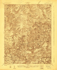
1923 Map of Lobelia
USGS Topo · Published 1923About this map
Little Levels and the headwaters of the Cherry and Cranberry rivers define this high-country landscape during the early 1920s. The area is characterized by a dense network of mountain schools and country churches serving remote timber and farming communities. Settlements like Lobelia and Oscar are connected by the historic Seneca Trail, which traverses the eastern slopes. The map reveals a high concentration of educational sites, such as Brushy Flat School and Pleasant Valley School, tucked into narrow valleys and along ridges.
Find a feature on this map
109 named features on this map. Tap any name to fly to it.
Don’t see what you’re looking for? This feature index may not catch every label — zoom into the map to look around manually.
Map Details
Editions of this 1923 Lobelia Map
2 editions found

Other maps of this area

1887 · Hinton
USGS Topo · 1:125,000

1887 · Lewisburg
USGS Topo · 1:125,000

1889 · Nicholas
USGS Topo · 1:125,000

1891 · Lewisburg
USGS Topo · 1:125,000

1891 · Nicholas
USGS Topo · 1:125,000

1891 · Huntersville
USGS Topo · 1:125,000

1892 · Hinton
USGS Topo · 1:125,000

1894 · Huntersville
USGS Topo · 1:125,000

1901 · Nicholas
USGS Topo · 1:125,000

1915 · Webster Springs
USGS Topo · 1:48,000