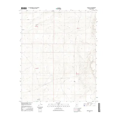
2017 Map of Lobo Hill NE
USGS Topo · Published 2017About this map
Chavez Draw and Rattlesnake Draw define the northern drainage patterns of this high-altitude landscape in Torrance County. The terrain is characterized by deep erosional features like Red Canyon, where seasonal runoff has carved distinct paths through the arid environment. A network of rural routes, including Co Rd A080 and Martinez Rd, provides the primary access across the township lines of T9N and T8N. The presence of Red Canyon Draw in the south illustrates the complex watershed system that shapes this portion of the New Mexico interior. Modern road labels like Side Winder and Co Rd A128 offer precise reference points for land management and local navigation in an area defined by its significant relief and natural watercourses.
Find a feature on this map
12 named features on this map. Tap any name to fly to it.
Don’t see what you’re looking for? This feature index may not catch every label — zoom into the map to look around manually.
Map Details
Editions of this 2017 Lobo Hill NE Map
This is the sole edition of this map. No revisions or reprints were ever made.
Other maps of this area

1894 · Lamy
USGS Topo · 1:125,000

1954 · Santa Fe
USGS Topo · 1:250,000

1954 · Fort Sumner
USGS Topo · 1:250,000

1958 · Fort Sumner
USGS Topo · 1:250,000

1958 · Santa Fe
USGS Topo · 1:250,000

1960 · Lobo Hill
USGS Topo · 1:62,500

1960 · Stanley
USGS Topo · 1:62,500
1966 · Clines Corners
USGS Topo · 1:24,000

1978 · Pedernal Mountain
USGS Topo · 1:24,000
1978 · Rock Lake
USGS Topo · 1:24,000