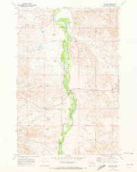
1969 Map of Locate
USGS Topo · Published 1973About this map
The Powder River carves a winding path through the heart of Custer County, shaping a landscape defined by an intricate network of drainages and ranching-related water management in the late 1960s. The small settlement of Locate sits at a critical junction where the highway crosses the river, marked by a Gaging Sta and a network of gravel roads branching into the surrounding hills. This survey records the practical infrastructure of Montana's high plains, highlighting numerous water sources such as Flowing Well and Holmes Flowing Well that supported livestock and habitation in this arid environment. The map details a complex drainage system including North Wolf Creek, Deep Creek, and Babbidge Creek, illustrating the natural conduits that lead toward the primary river valley. Commercial activity is represented by localized Gravel Pits, situated near the primary crossing at Locate.
Find a feature on this map
18 named features on this map. Tap any name to fly to it.
Don’t see what you’re looking for? This feature index may not catch every label — zoom into the map to look around manually.
Map Details
Editions of this 1969 Locate Map
This is the sole edition of this map. No revisions or reprints were ever made.
Other maps of this area

1953 · Miles City
USGS Topo · 1:250,000

1957 · Miles City
USGS Topo · 1:250,000

1958 · Miles City
USGS Topo · 1:250,000

1969 · Corral Butte
USGS Topo · 1:24,000

1969 · Spring Draw
USGS Topo · 1:24,000

1969 · Hogan Creek
USGS Topo · 1:24,000

1969 · Locate SE
USGS Topo · 1:24,000

1969 · Flat Top Butte SW
USGS Topo · 1:24,000

1969 · Buck Mountain
USGS Topo · 1:24,000
1969 · Red Knob
USGS Topo · 1:24,000