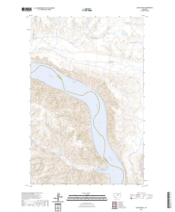
2024 Map of Locke Ranch
USGS Topo · Published 2024About this map
Fort Peck Lake dominates this Montana landscape, where the Missouri River winds through a complex system of breaks and coulees. The map highlights the extensive conservation areas surrounding the water, including the UL Bend Wilderness and the UL Bend National Wildlife Refuge, which protect the unique habitat of the river’s sharp southern curve. To the south, the Charles M Russell National Wildlife Refuge further defines the character of this protected prairie ecosystem. Industrial activity is present through the Phillips Co Petroleum Co operations, while local movement is traced via Midale Rd and the Musselshell Trl. The terrain is marked by numerous drainages such as Dam Coulee, Soda Creek, and Coburn Coulee, illustrating the intricate erosion patterns typical of the Missouri River country.
Find a feature on this map
22 named features on this map. Tap any name to fly to it.
Don’t see what you’re looking for? This feature index may not catch every label — zoom into the map to look around manually.
Map Details
Editions of this 2024 Locke Ranch Map
This is the sole edition of this map. No revisions or reprints were ever made.
Other maps of this area

1954 · Jordan
USGS Topo · 1:250,000

1954 · Lewistown
USGS Topo · 1:250,000

1956 · Jordan
USGS Topo · 1:250,000

1958 · Jordan
USGS Topo · 1:250,000

1959 · Lewistown
USGS Topo · 1:250,000

1964 · Jordan
USGS Topo · 1:250,000

1965 · Karsten Coulee
USGS Topo · 1:24,000

1965 · Germaine Coulee East
USGS Topo · 1:24,000

1965 · Germaine Coulee West
USGS Topo · 1:24,000

1965 · Chain Buttes
USGS Topo · 1:24,000