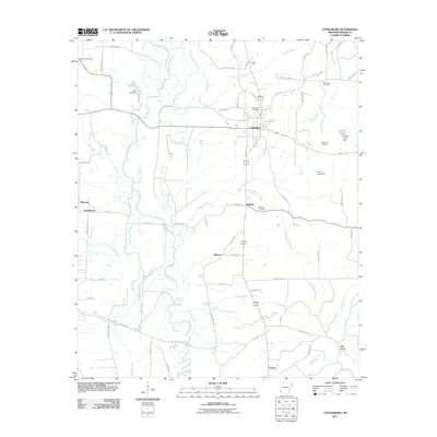
2011 Map of Lockesburg
USGS Topo · Published 2011About this map
Lockesburg serves as the primary hub of this eastern Sevier County landscape, situated where the terrain transitions toward the winding Cossatot River. The river and its complex drainage system, including White Oak Slough, Mill Slough, and the Little Cossatot River, dominate the western half of the map, illustrating a landscape defined by seasonal water movements and low-lying bottomlands. Small rural settlements like Bellville, Milrose, and Dilworth are scattered throughout the region, connected by a network of local roads such as Provo Rd and Richmond Rd.
Find a feature on this map
82 named features on this map. Tap any name to fly to it.
Don’t see what you’re looking for? This feature index may not catch every label — zoom into the map to look around manually.
Map Details
Editions of this 2011 Lockesburg Map
This is the sole edition of this map. No revisions or reprints were ever made.
Other maps of this area

1913 · De Queen
USGS Topo · 1:125,000

1950 · Mcalester
USGS Topo · 1:250,000

1950 · Ben Lomond
USGS Topo · 1:24,000

1950 · Falls Chapel
USGS Topo · 1:24,000

1950 · Winthrop
USGS Topo · 1:24,000

1951 · Winthrop
USGS Topo · 1:24,000

1951 · Ben Lomond
USGS Topo · 1:24,000

1951 · Falls Chapel
USGS Topo · 1:24,000

1951 · Horatio
USGS Topo · 1:24,000

1951 · Lockesburg
USGS Topo · 1:24,000