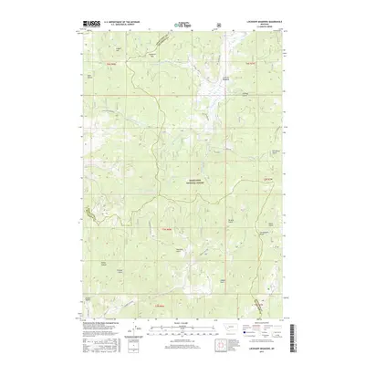
2017 Map of Lockhart Meadows
USGS Topo · Published 2017About this map
The Continental Divide defines the eastern orientation of this landscape within the Deerlodge National Forest, where the headwaters of the Boulder River and its various forks carve deep drainages through the high country. To the north, Lockhart Meadows and Gospel Hill sit near the divide, while Champion Pass provides a transition between the northern and southern watersheds. The map reveals a complex network of named gulches and canyons, such as American Gulch, Alaska Gulch, and Strozzy Gulch, many of which bear the names of early prospectors and settlers who frequented this mineral-rich region of Montana. High-altitude drainage patterns are clearly visible through features like N Fork Dry Cottonwood Cr and W Fork Boulder River, illustrating the rugged hydrology of the Silver Bow and Jefferson County line.
Find a feature on this map
36 named features on this map. Tap any name to fly to it.
Don’t see what you’re looking for? This feature index may not catch every label — zoom into the map to look around manually.
Map Details
Editions of this 2017 Lockhart Meadows Map
This is the sole edition of this map. No revisions or reprints were ever made.
Other maps of this area

1889 · Helena
USGS Topo · 1:250,000

1893 · Helena
USGS Topo · 1:250,000

1899 · Boulder
USGS Topo · 1:125,000

1899 · Helena
USGS Topo · 1:250,000

1903 · Helena
USGS Topo · 1:250,000

1947 · Butte
USGS Topo · 1:250,000

1954 · Elk Park
USGS Topo · 1:62,500

1954 · Basin
USGS Topo · 1:62,500

1958 · Butte
USGS Topo · 1:250,000

1959 · Butte North
USGS Topo · 1:62,500