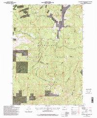
1996 Map of Lockhart Meadows
USGS Topo · Published 1998About this map
Continental Divide crests through this mountain landscape, marking the high-altitude boundary between the Deer Lodge National Forest and the upper drainages of the Boulder River. This mid-1990s survey by the U.S. Forest Service documents a region defined by historical mining activity and natural topography, with the Champion Mine and several other Prospects situated near Champion Pass. These features indicate the area's history of extraction near the summit of Gospel Hill.
Find a feature on this map
39 named features on this map. Tap any name to fly to it.
Don’t see what you’re looking for? This feature index may not catch every label — zoom into the map to look around manually.
Map Details
Editions of this 1996 Lockhart Meadows Map
This is the sole edition of this map. No revisions or reprints were ever made.
Other maps of this area

1889 · Helena
USGS Topo · 1:250,000

1893 · Helena
USGS Topo · 1:250,000

1899 · Boulder
USGS Topo · 1:125,000

1899 · Helena
USGS Topo · 1:250,000

1903 · Helena
USGS Topo · 1:250,000

1947 · Butte
USGS Topo · 1:250,000

1954 · Elk Park
USGS Topo · 1:62,500

1954 · Basin
USGS Topo · 1:62,500

1958 · Butte
USGS Topo · 1:250,000

1959 · Butte North
USGS Topo · 1:62,500