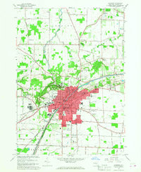
1965 Map of Lockport
USGS Topo · Published 1968About this map
The Erie Canal anchors this mid-century view of the region, cutting diagonally through the heart of Lockport and past the Niagara County Courthouse. This 1965 revision shows the city's mid-century expansion through planned developments like Carlisle Gardens and Nottingham Estates, while older institutional landmarks like the Wyndham Lawn Home, IOOF Home, and the County Jail remain prominent on the landscape. The terrain is defined by the sharp ravine of The Gulf and the course of Eighteenmile Creek flowing north toward Newfane.
Find a feature on this map
90 named features on this map. Tap any name to fly to it.
Don’t see what you’re looking for? This feature index may not catch every label — zoom into the map to look around manually.
Map Details
Editions of this 1965 Lockport Map
This is the sole edition of this map. No revisions or reprints were ever made.
Other maps of this area

1894 · Wilson
USGS Topo · 1:62,500

1897 · Tonawanda
USGS Topo · 1:62,500

1897 · Olcott
USGS Topo · 1:62,500

1897 · Lockport
USGS Topo · 1:62,500

1899 · Niagara
USGS Topo · 1:125,000

1900 · Wilson
USGS Topo · 1:62,500

1900 · Tonawanda
USGS Topo · 1:62,500

1901 · Tonawanda
USGS Topo · 1:62,500

1902 · Lockport
USGS Topo · 1:62,500

1905 · Lockport
USGS Topo · 1:62,500