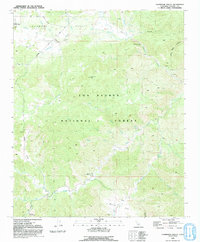
1991 Map of Lockwood Valley
USGS Topo · Published 1991About this map
Los Padres National Forest dominates this mountain landscape, providing a detailed view of the high-country wilderness in Ventura County during the late 1980s. The map illustrates the convergence of several major drainage systems, including Piru Creek, Mutau Creek, and Amargosa Creek, which carve through the high elevations of Lockwood Valley. Human activity is concentrated around recreational outposts and ranching infrastructure, such as Halfmoon Campground, Snedden Campground, and various Corrals scattered across the valley floor. Evidence of resource extraction and geological study is visible through several marked Prospect sites, a Borrow Pit, and a Drill Hole located near Grade Valley. Notable peaks like Lockwood Peak and the expansive Mutau Flat define the topography, while a remote Landing Strip in the northwest corner highlights the area's isolation.
Find a feature on this map
36 named features on this map. Tap any name to fly to it.
Don’t see what you’re looking for? This feature index may not catch every label — zoom into the map to look around manually.
Map Details
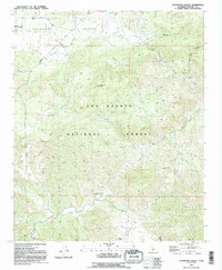
Editions of this 1991 Lockwood Valley Map
2 editions found
Other maps of this area

1903 · Mt. Pinos
USGS Topo · 1:125,000

1903 · Tejon
USGS Topo · 1:125,000

1942 · Frazier Mountain
USGS Topo · 1:24,000

1943 · Topatopa Mountains
USGS Topo · 1:24,000

1943 · San Guillermo
USGS Topo · 1:24,000

1943 · Sawmill Mountain
USGS Topo · 1:24,000

1943 · Cuddy Valley
USGS Topo · 1:24,000

1943 · Lockwood Valley
USGS Topo · 1:24,000

1943 · Lion Canyon
USGS Topo · 1:24,000
1943 · Devils Heart Peak
USGS Topo · 1:24,000