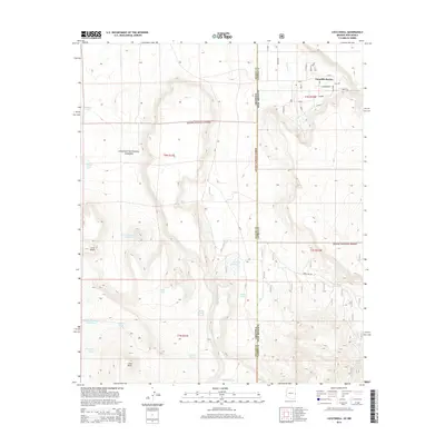
2014 Map of Loco Knoll
USGS Topo · Published 2014About this map
The settlement of Escudilla Bonita anchors the northeastern corner of this high-altitude landscape, where the Arizona and New Mexico border meets the rugged terrain of the Apache National Forest. This 2014 survey reveals an arid ranching environment heavily dependent on water management, evidenced by the dense network of tanks and springs scattered across the territory. Landmarks like Loco Knoll and the adjacent Loco Knolls dominate the southern half of the quadrangle, surrounded by essential water sources such as Loco Knoll-Number Three Tank and Thomas Spring. The map documents a complex system of forest roads and residential ways, including Hummingbird and Lapp Ln, facilitating access to remote properties near Coyote Cr. Significant water features like Pratt Lake and the H-V Reservoir highlight the critical infrastructure required for settlement in this part of Apache County.
Find a feature on this map
37 named features on this map. Tap any name to fly to it.
Don’t see what you’re looking for? This feature index may not catch every label — zoom into the map to look around manually.
Map Details
Editions of this 2014 Loco Knoll Map
This is the sole edition of this map. No revisions or reprints were ever made.
Other maps of this area

1886 · St Johns
USGS Topo · 1:250,000

1892 · St Johns
USGS Topo · 1:250,000

1915 · Reserve
USGS Topo · 1:125,000

1918 · Reserve
USGS Topo · 1:125,000

1922 · Nutrioso
USGS Topo · 1:125,000

1954 · Clifton
USGS Topo · 1:250,000

1954 · Saint Johns
USGS Topo · 1:250,000

1957 · Clifton
USGS Topo · 1:250,000

1957 · Saint Johns
USGS Topo · 1:250,000

1958 · Clifton
USGS Topo · 1:250,000