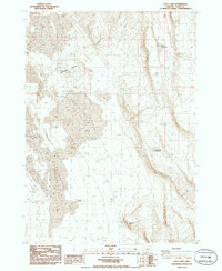
1986 Map of Loco Lake
USGS Topo · Published 1986About this map
Tenmile Ridge dominates this high desert landscape in Lake County, defining the eastern edge of a vast drainage basin. In the mid-1980s, this area of south-central Oregon was characterized by its ephemeral water sources and shifting terrain, including expansive fields of Sand Dunes and the prominent Alkali Flat. The central feature, Loco Lake, is surrounded by numerous Prospects, indicating historic mineral exploration in the vicinity. Vital water points for livestock or local wildlife are marked at Bailey Waterhole and South Cat Waterhole, highlighting the arid nature of the region. The map also identifies Fivemile Point to the south, where the rising terrain begins to break the level expanse of the lake bed. This document serves as a detailed record of the land use and natural topography before significant environmental or management changes in the high desert.
Find a feature on this map
10 named features on this map. Tap any name to fly to it.
Don’t see what you’re looking for? This feature index may not catch every label — zoom into the map to look around manually.
Map Details
Editions of this 1986 Loco Lake Map
This is the sole edition of this map. No revisions or reprints were ever made.
Other maps of this area

1955 · Klamath Falls
USGS Topo · 1:250,000

1958 · Klamath Falls
USGS Topo · 1:250,000

1966 · Slide Mtn
USGS Topo · 1:24,000

1966 · Coglan Buttes
USGS Topo · 1:24,000

1966 · Paisley
USGS Topo · 1:24,000

1974 · Lake Abert
USGS Topo · 1:100,000

1985 · Sharp Top
USGS Topo · 1:24,000
1986 · Ana River
USGS Topo · 1:24,000
1986 · Bull Lake
USGS Topo · 1:24,000
1986 · South of Ana River
USGS Topo · 1:24,000