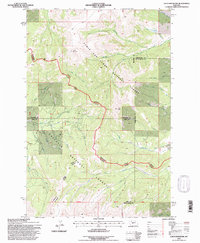
1995 Map of Loco Mountain
USGS Topo · Published 1997About this map
Loco Mountain dominates this high-elevation divide where four counties — Meagher, Wheatland, Sweet Grass, and Park — converge. As a 1995 revision of earlier aerial surveys, the map illustrates the complex drainage network of the Lewis and Clark National Forest and Gallatin National Forest. The landscape is defined by the headwaters of several major systems, including the Shields River flowing south and the South Fork Musselshell River carving through the eastern slopes. Near the northern boundary, Elk Lake sits at the base of steep ridges that feed into Big Elk Creek. The area is navigated by high-altitude routes such as the Musselshell Big Timber road and the Livingston Big Timber road, which trace the natural contours of the terrain near Lebo Peak. The map provides an intricate look at the watershed boundaries and Forest Service infrastructure at the end of the twentieth century.
Find a feature on this map
33 named features on this map. Tap any name to fly to it.
Don’t see what you’re looking for? This feature index may not catch every label — zoom into the map to look around manually.
Map Details
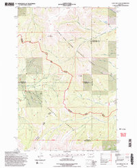
Editions of this 1995 Loco Mountain Map
2 editions found
Other maps of this area

1886 · Little Belt Mts.
USGS Topo · 1:250,000

1894 · Little Belt Mts.
USGS Topo · 1:250,000

1897 · Little Belt Mts.
USGS Topo · 1:250,000

1898 · Little Belt Mts.
USGS Topo · 1:250,000

1902 · Little Belt Mts.
USGS Topo · 1:250,000

1948 · White Sulphur Springs
USGS Topo · 1:250,000

1958 · White Sulphur Springs
USGS Topo · 1:250,000

1961 · White Sulphur Springs
USGS Topo · 1:250,000

1965 · White Sulphur Springs
USGS Topo · 1:250,000
1972 · Virginia Peak
USGS Topo · 1:24,000