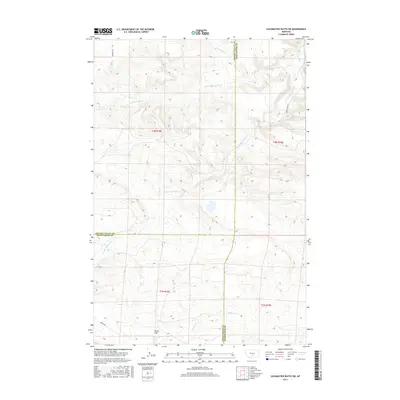
2017 Map of Locomotive Butte SW
USGS Topo · Published 2017About this map
Knob Hill rises as a prominent landmark in this section of the Montana plains where the borders of Golden Valley, Sweet Grass, and Stillwater Counties meet. The landscape is defined by the complex drainage system of Big Coulee Cr, which branches into the N Fork Big Coulee Cr and the S Fork Big Coulee Cr as they cut through the terrain. This 2017 survey reveals a sparsely populated ranching environment where movement is dictated by the coulees and primitive routes like Hines Ranch Rd and Gibson Rd. Other watercourses including Sixshooter Cr, Van Winkle Cr, and Whitney Cr snake across the sections, illustrating the vital role of seasonal hydrology in this high-plains environment. The map provides a precise look at the township and range divisions, showing the intersection of T4N and T3N with R18E and R19E.
Find a feature on this map
17 named features on this map. Tap any name to fly to it.
Don’t see what you’re looking for? This feature index may not catch every label — zoom into the map to look around manually.
Map Details
Editions of this 2017 Locomotive Butte SW Map
This is the sole edition of this map. No revisions or reprints were ever made.
Other maps of this area

1889 · Big Snowy Mountain
USGS Topo · 1:250,000

1891 · Big Timber
USGS Topo · 1:125,000

1892 · Stillwater
USGS Topo · 1:125,000

1893 · Big Snowy Mountain
USGS Topo · 1:250,000

1893 · Big Timber
USGS Topo · 1:125,000

1954 · Billings
USGS Topo · 1:250,000

1954 · Roundup
USGS Topo · 1:250,000

1955 · Russell Gulch
USGS Topo · 1:24,000

1956 · Rapelje
USGS Topo · 1:24,000

1957 · Billings
USGS Topo · 1:250,000