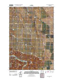
2011 Map of Locust Grove
USGS Topo · Published 2011About this map
The Locust Grove settlement is the namesake of this high plateau landscape in Wasco County, where the topography is defined by the deep incisions of the Deschutes River and its accompanying canyon systems. Moving south from the community, the land rises across Gordon Ridge and drops sharply along the Rattlesnake Grade, revealing a network of drainage features like Shotgun Canyon and Sayrs Canyon. The reliance on local hydrology in this arid environment is evident from the mapping of scattered water sources such as Sand Spring, Wingate Spring, and Jackass Spring. Transportation in this part of Oregon follows the natural contours and property lines of the wheat-growing country, with roads like Gordon Ridge Rd and Wheatacres Rd providing access to isolated canyons. Near the river, Harris Island and Fall Canyon mark the complex boundary between the upland agricultural benches and the riparian corridor below.
Find a feature on this map
32 named features on this map. Tap any name to fly to it.
Don’t see what you’re looking for? This feature index may not catch every label — zoom into the map to look around manually.
Map Details
Editions of this 2011 Locust Grove Map
This is the sole edition of this map. No revisions or reprints were ever made.
Other maps of this area

1953 · The Dalles
USGS Topo · 1:250,000

1956 · The Dalles
USGS Topo · 1:250,000

1957 · The Dalles
USGS Topo · 1:250,000

1957 · Wasco
USGS Topo · 1:62,500

1957 · Wishram
USGS Topo · 1:62,500

1962 · Erskine
USGS Topo · 1:24,000

1962 · Summit Ridge
USGS Topo · 1:24,000

1971 · Moro
USGS Topo · 1:24,000

1971 · Rufus
USGS Topo · 1:24,000
1971 · Wasco
USGS Topo · 1:24,000