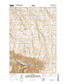
2014 Map of Locust Grove
USGS Topo · Published 2014About this map
Locust Grove serves as the focal point of this high-plateau landscape, where the grain fields and canyons of the Columbia Plateau transition toward the river. The southern edge of the survey is defined by the winding course of the Deschutes River, which forms the boundary between Sherman and Wasco Counties. This river valley is a complex network of named drainages including Harris, Fall, and Mays, alongside the significant Harris Island within the river's flow. Further north, the terrain is characterized by long ridges and deep coulees, most notably Gordon Ridge and Mud Hollow. The map highlights a remote road network that includes the winding Rattlesnake Grade and Or-206, connecting these upland agricultural areas to the river below. Isolated water sources like Sand Spring and Wingate Spring are vital markers in this semi-arid environment, illustrating the geographic constraints on local settlement and ranching.
Find a feature on this map
42 named features on this map. Tap any name to fly to it.
Don’t see what you’re looking for? This feature index may not catch every label — zoom into the map to look around manually.
Map Details
Editions of this 2014 Locust Grove Map
This is the sole edition of this map. No revisions or reprints were ever made.
Other maps of this area

1953 · The Dalles
USGS Topo · 1:250,000

1956 · The Dalles
USGS Topo · 1:250,000

1957 · The Dalles
USGS Topo · 1:250,000

1957 · Wasco
USGS Topo · 1:62,500

1957 · Wishram
USGS Topo · 1:62,500

1962 · Erskine
USGS Topo · 1:24,000

1962 · Summit Ridge
USGS Topo · 1:24,000

1971 · Moro
USGS Topo · 1:24,000

1971 · Rufus
USGS Topo · 1:24,000
1971 · Wasco
USGS Topo · 1:24,000