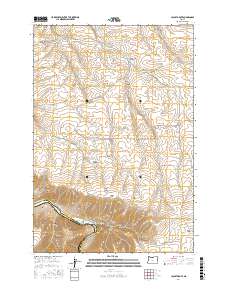
2017 Map of Locust Grove
USGS Topo · Published 2017About this map
Locust Grove and its surrounding canyons define the landscape of this region along the border of Sherman and Wasco Counties. The terrain is deeply incised by drainages such as Frank Fulton Canyon, Neece Canyon, and Sayrs Canyon, which all feed toward the winding corridor of the Deschutes River at the southwest corner. The river is a focal point for modern recreation and historic movement, featuring the Deschutes River Trail and Harris Island. Steep elevation changes are navigated via landmarks like Rattlesnake Grade, while the upland plateau is marked by a network of ranch roads including Wheatacres Rd and Goat Ranch Ln. Natural water sources such as Sand Spring, Wingate Spring, and Jackass Spring appear as critical survival points in this arid, high-country environment.
Find a feature on this map
46 named features on this map. Tap any name to fly to it.
Don’t see what you’re looking for? This feature index may not catch every label — zoom into the map to look around manually.
Map Details
Editions of this 2017 Locust Grove Map
This is the sole edition of this map. No revisions or reprints were ever made.
Other maps of this area

1953 · The Dalles
USGS Topo · 1:250,000

1956 · The Dalles
USGS Topo · 1:250,000

1957 · The Dalles
USGS Topo · 1:250,000

1957 · Wasco
USGS Topo · 1:62,500

1957 · Wishram
USGS Topo · 1:62,500

1962 · Erskine
USGS Topo · 1:24,000

1962 · Summit Ridge
USGS Topo · 1:24,000

1971 · Moro
USGS Topo · 1:24,000

1971 · Rufus
USGS Topo · 1:24,000
1971 · Wasco
USGS Topo · 1:24,000