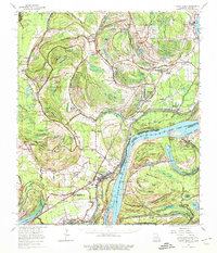
1965 Map of Locust Ridge
USGS Topo · Published 1974About this map
The Missouri Pacific rail line and a complex network of bayous define this Mississippi River landscape during the mid-1960s. The town of Waterproof serves as a central hub, surrounded by an agricultural pattern of named estates including Arcola Plantation, Newfoundland Plantation, and Winona Plantation. This area in Tensas Parish is heavily influenced by the river's shifting path, evidenced by the Waterproof Cutoff and numerous oxbow features like Lake Bruin and Old Bed Lake.
Find a feature on this map
154 named features on this map. Tap any name to fly to it.
Don’t see what you’re looking for? This feature index may not catch every label — zoom into the map to look around manually.
Map Details
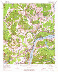
Editions of this 1965 Locust Ridge Map
2 editions found
Other maps of this area

1909 · Delta Bridge
USGS Topo · 1:24,000

1909 · Lake Bruen
USGS Topo · 1:24,000

1921 · Natchez
USGS Topo · 1:48,000

1922 · Natchez
USGS Topo · 1:62,500

1935 · Winnsboro
USGS Topo · 1:62,500

1935 · Shackleford Lake
USGS Topo · 1:62,500

1939 · Red Gum
USGS Topo · 1:62,500

1939 · Lorman
USGS Topo · 1:62,500

1939 · Natchez
USGS Topo · 1:62,500

1939 · Locust Ridge
USGS Topo · 1:62,500