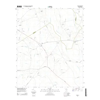
2014 Map of Lodge
USGS Topo · Published 2014About this map
Little Salkehatchie River meanders through the heart of this Lowcountry landscape, defining the boundary between Bamberg and Colleton counties. The area is characterized by an intricate network of waterways like Willow Swamp and Dry Br, which separate the small rural settlements of Ehrhardt, Lodge, and Ashton. For genealogists and local historians, the sheet is particularly valuable for its documentation of numerous family and community burial sites, including Bethany Cem, Jones Cem, and Goodwin Cem. Transport routes such as the Confederate Hwy and Bells Hwy connect these clusters of South Carolina history, while the presence of the Shiloh Plantation Airport and the uniquely named Cantaloupe Belt suggest the localized agricultural and private land uses of the modern era.
Find a feature on this map
76 named features on this map. Tap any name to fly to it.
Don’t see what you’re looking for? This feature index may not catch every label — zoom into the map to look around manually.
Map Details
Editions of this 2014 Lodge Map
This is the sole edition of this map. No revisions or reprints were ever made.
Other maps of this area

1918 · Varnville
USGS Topo · 1:62,500

1919 · Olar
USGS Topo · 1:62,500

1919 · Cummings
USGS Topo · 1:62,500

1919 · Lodge
USGS Topo · 1:62,500

1920 · Lodge
USGS Topo · 1:48,000

1921 · Lodge
USGS Topo · 1:62,500

1943 · Olar
USGS Topo · 1:62,500

1943 · Lodge
USGS Topo · 1:62,500

1943 · Orangeburg
USGS Topo · 1:125,000

1943 · Cummings
USGS Topo · 1:62,500