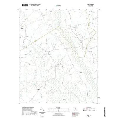
2020 Map of Lodge
USGS Topo · Published 2020About this map
The Little Salkehatchie River and its myriad tributaries, including Willow Swamp and Dry Br, form the primary geographic character of this South Carolina Lowcountry landscape. Small rural communities like Lodge and Ashton are central to the region, which is marked by a network of local roads such as Buttermilk Rd and the Cantaloupe Belt. For genealogists and local historians, several burial sites are recorded, including Bethany Cem, Lodge Cem, and Ashton Cem, often situated near family-named landmarks like Horse Bay or the Shiloh Plantation Airport. The transition from the town center of Ehrhardt to the more dispersed settlements of Caldwell and Colleton illustrates a traditional agricultural settlement pattern that persists even into the twenty-first century, anchored by the swamp-and-creek drainage system of the Bamberg and Colleton Co borderlands.
Find a feature on this map
77 named features on this map. Tap any name to fly to it.
Don’t see what you’re looking for? This feature index may not catch every label — zoom into the map to look around manually.
Map Details
Editions of this 2020 Lodge Map
This is the sole edition of this map. No revisions or reprints were ever made.
Other maps of this area

1918 · Varnville
USGS Topo · 1:62,500

1919 · Olar
USGS Topo · 1:62,500

1919 · Cummings
USGS Topo · 1:62,500

1919 · Lodge
USGS Topo · 1:62,500

1920 · Lodge
USGS Topo · 1:48,000

1921 · Lodge
USGS Topo · 1:62,500

1943 · Olar
USGS Topo · 1:62,500

1943 · Lodge
USGS Topo · 1:62,500

1943 · Orangeburg
USGS Topo · 1:125,000

1943 · Cummings
USGS Topo · 1:62,500