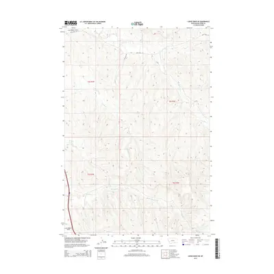
2014 Map of Lodge Grass NE
USGS Topo · Published 2014About this map
The Little Bighorn Valley dominates the southwestern corner of this landscape, marking a significant topographical transition in Big Horn County. This area is defined by a dense network of drainage systems, including the headwaters and winding paths of Reno Cr and its S Fork Reno Cr in the northeast, while Long Otter Cr carves through the central townships. The map illustrates a primarily rural and undeveloped terrain during the early 21st century, with movement across the land dictated by established routes such as Davis Creek Rd and Reno Inlet Dr. Further south, the terrain is shaped by the parallel courses of Shavings Cr and Slaughter Cr. This detailed 2014 survey documents the complex hydrology and primitive road network across townships T4S and T5S, providing a clear record of the area's physical geography.
Find a feature on this map
13 named features on this map. Tap any name to fly to it.
Don’t see what you’re looking for? This feature index may not catch every label — zoom into the map to look around manually.
Map Details
Editions of this 2014 Lodge Grass NE Map
This is the sole edition of this map. No revisions or reprints were ever made.
Other maps of this area

1894 · Rosebud
USGS Topo · 1:125,000

1901 · Rosebud
USGS Topo · 1:125,000

1954 · Hardin
USGS Topo · 1:250,000

1957 · Hardin
USGS Topo · 1:250,000

1958 · Hardin
USGS Topo · 1:250,000

1967 · Crow Agency SE
USGS Topo · 1:24,000

1967 · Lodge Grass NE
USGS Topo · 1:24,000

1967 · Wolf Mountain Lookout
USGS Topo · 1:24,000
1967 · Benteen
USGS Topo · 1:24,000
1967 · Crow Agency
USGS Topo · 1:24,000