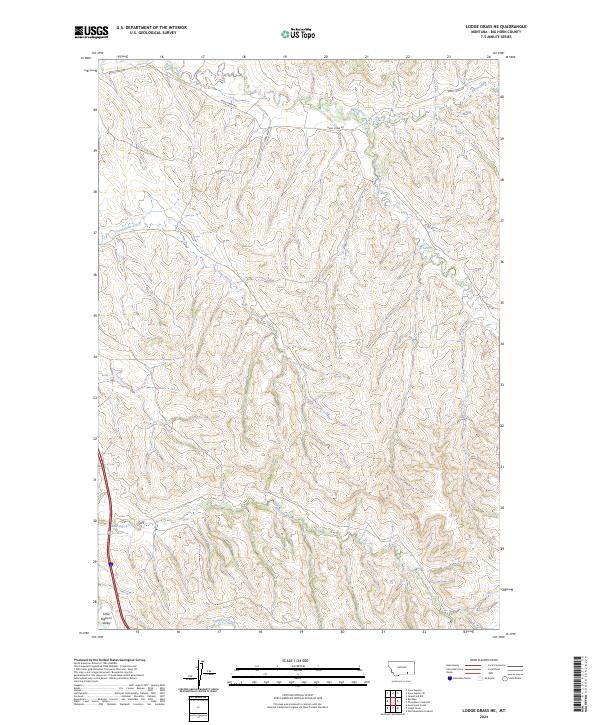
2024 Map of Lodge Grass NE
USGS Topo · Published 2024About this map
The Little Bighorn Valley defines the western edge of this Big Horn County landscape, where the terrain transitions into a complex network of ridges and drainages. The hydrology of the region is characterized by eastward-flowing tributaries, most notably Reno Creek and its tributary South Fork Reno Creek, which carve significant paths through the high plains. Further south, the map documents the courses of Long Otter Creek, Shavings Creek, and Slaughter Creek, illustrating the natural drainage patterns that have historically influenced land use and movement in this part of Montana.
Find a feature on this map
12 named features on this map. Tap any name to fly to it.
Don’t see what you’re looking for? This feature index may not catch every label — zoom into the map to look around manually.
Map Details
Editions of this 2024 Lodge Grass NE Map
This is the sole edition of this map. No revisions or reprints were ever made.
Other maps of this area

1894 · Rosebud
USGS Topo · 1:125,000

1901 · Rosebud
USGS Topo · 1:125,000

1954 · Hardin
USGS Topo · 1:250,000

1957 · Hardin
USGS Topo · 1:250,000

1958 · Hardin
USGS Topo · 1:250,000

1967 · Crow Agency SE
USGS Topo · 1:24,000

1967 · Lodge Grass NE
USGS Topo · 1:24,000

1967 · Wolf Mountain Lookout
USGS Topo · 1:24,000
1967 · Benteen
USGS Topo · 1:24,000
1967 · Crow Agency
USGS Topo · 1:24,000