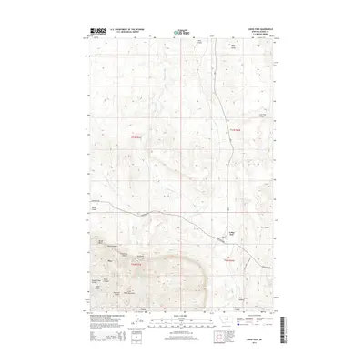
2014 Map of Lodge Pole
USGS Topo · Published 2014About this map
The Little Rocky Mountains rise sharply in the southwest, giving way to a landscape of deep canyons and seasonal drainage coulees. The settlement of Lodge Pole serves as a primary local hub, connected via Lodgepole Rd and the Bia-8 route. The geography here is defined by these complex watercourses, where names like Valentine Canyon, Jim Brown Canyon, and White Horse Canyon indicate a long history of local identification with specific draws and ridgelines. To the west, the community of Hays sits near the base of the mountains, sheltered by features such as Mouse Butte and Mouse Canyon. The transition from the high peaks to the lower plains is marked by springs and creek beds, including Blackbull Spring and the meandering Lodge Pole Cr, which help define the ranching and residential patterns of the area.
Find a feature on this map
23 named features on this map. Tap any name to fly to it.
Don’t see what you’re looking for? This feature index may not catch every label — zoom into the map to look around manually.
Map Details
Editions of this 2014 Lodge Pole Map
This is the sole edition of this map. No revisions or reprints were ever made.
Other maps of this area

1943 · Landusky
USGS Topo · 1:125,000

1953 · Havre
USGS Topo · 1:250,000

1954 · Lewistown
USGS Topo · 1:250,000

1957 · Havre
USGS Topo · 1:250,000

1958 · Havre
USGS Topo · 1:250,000

1959 · Lewistown
USGS Topo · 1:250,000

1971 · Bear Mountain
USGS Topo · 1:24,000

1971 · Hays
USGS Topo · 1:24,000

1971 · Lodge Pole NW
USGS Topo · 1:24,000

1971 · Lodge Pole NE
USGS Topo · 1:24,000
Featured Places
- Lodge Pole, Lodge Pole District
- Lodge Pole District, MT
- Hays District, MT
- Hays, Hays District
- Blaine County, MT