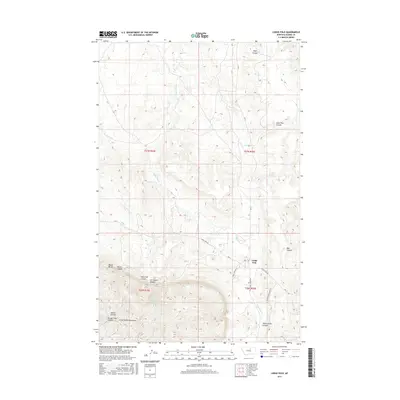
2017 Map of Lodge Pole
USGS Topo · Published 2017About this map
Lodge Pole serves as a central hub in this Montana landscape, where the northern foothills of the Little Rocky Mountains transition into a series of deep drainages and canyons. The topography is defined by the carved paths of Lodge Pole Cr and Jim Brown Cr, which flow through a network of coulees including Wolf Coulee and Lone Tree Coulee. To the south and west, the terrain rises sharply toward Mouse Butte and Mouse Canyon, illustrating the high-relief landscape of Blaine County. A complex network of local routes, such as Lodge Pole Rd and White Horse Canyon Rd, follows the natural contours of the land, connecting the settlement to secluded features like Blackbull Spring and Valentine Canyon.
Find a feature on this map
25 named features on this map. Tap any name to fly to it.
Don’t see what you’re looking for? This feature index may not catch every label — zoom into the map to look around manually.
Map Details
Editions of this 2017 Lodge Pole Map
This is the sole edition of this map. No revisions or reprints were ever made.
Other maps of this area

1943 · Landusky
USGS Topo · 1:125,000

1953 · Havre
USGS Topo · 1:250,000

1954 · Lewistown
USGS Topo · 1:250,000

1957 · Havre
USGS Topo · 1:250,000

1958 · Havre
USGS Topo · 1:250,000

1959 · Lewistown
USGS Topo · 1:250,000

1971 · Bear Mountain
USGS Topo · 1:24,000

1971 · Hays
USGS Topo · 1:24,000

1971 · Lodge Pole NW
USGS Topo · 1:24,000

1971 · Lodge Pole NE
USGS Topo · 1:24,000
Featured Places
- Lodge Pole, Lodge Pole District
- Lodge Pole District, MT
- Hays District, MT
- Hays, Hays District
- Blaine County, MT