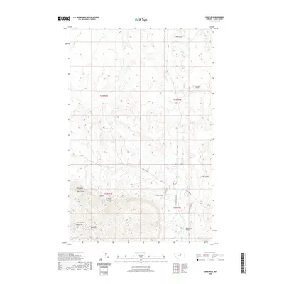
2020 Map of Lodge Pole
USGS Topo · Published 2020About this map
The settlement of Lodge Pole serves as the central hub of this northern Montana landscape, situated where the southern coulees meet the northern slopes of the Little Rocky Mountains. The terrain transitions from the broader drainages of Wolf Coulee and Lone Tree Coulee in the north to a more intricate network of canyons in the south. These deep incisions, such as Valentine Canyon, Jim Brown Canyon, and White Horse Canyon, reveal the complex geography of the mountain foothills. The road network connects these remote points through routes like Dora Helgeson Rd and Lodge Pole Rd. Notable landmarks such as Mouse Butte and Blackbull Spring indicate reliable water sources and navigational markers that have likely served local residents and travelers for generations. The map provides a contemporary view of the region, documenting the modern infrastructure of Jenny Gray Rd and Little Chief Canyon Rd as they navigate the area's sharp elevation changes.
Find a feature on this map
26 named features on this map. Tap any name to fly to it.
Don’t see what you’re looking for? This feature index may not catch every label — zoom into the map to look around manually.
Map Details
Editions of this 2020 Lodge Pole Map
This is the sole edition of this map. No revisions or reprints were ever made.
Other maps of this area

1943 · Landusky
USGS Topo · 1:125,000

1953 · Havre
USGS Topo · 1:250,000

1954 · Lewistown
USGS Topo · 1:250,000

1957 · Havre
USGS Topo · 1:250,000

1958 · Havre
USGS Topo · 1:250,000

1959 · Lewistown
USGS Topo · 1:250,000

1971 · Bear Mountain
USGS Topo · 1:24,000

1971 · Hays
USGS Topo · 1:24,000

1971 · Lodge Pole NW
USGS Topo · 1:24,000

1971 · Lodge Pole NE
USGS Topo · 1:24,000
Featured Places
- Lodge Pole, Lodge Pole District
- Lodge Pole District, MT
- Hays District, MT
- Hays, Hays District
- Blaine County, MT