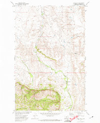
1971 Map of Lodge Pole
USGS Topo · Published 1974About this map
Lodge Pole sits at the northern edge of the Little Rocky Mountains, serving as a central settlement within the Fort Belknap Indian Reservation during this 1970s survey. The landscape transitions sharply from the elevated ridges of Jim Brown Canyon and Valentine Canyon in the south to the more level terrain of the Missouri River Basin to the north. Lodge Pole Creek winds through the center of the sheet, providing a vital water source for the community and surrounding ranching activities. Land use in the early 1970s is indicated by a Prospect and a Gravel Pit near Mouse Butte, alongside various unnamed springs and the named Black Bull Spring. The map documents the intersection of indigenous geography and industrial activity, evidenced by the network of local roads and a Jeep Trail that climb into the higher elevations of White Cow Canyon.
Find a feature on this map
13 named features on this map. Tap any name to fly to it.
Don’t see what you’re looking for? This feature index may not catch every label — zoom into the map to look around manually.
Map Details
Editions of this 1971 Lodge Pole Map
This is the sole edition of this map. No revisions or reprints were ever made.
Other maps of this area

1943 · Landusky
USGS Topo · 1:125,000

1953 · Havre
USGS Topo · 1:250,000

1954 · Lewistown
USGS Topo · 1:250,000

1957 · Havre
USGS Topo · 1:250,000

1958 · Havre
USGS Topo · 1:250,000

1959 · Lewistown
USGS Topo · 1:250,000

1971 · Bear Mountain
USGS Topo · 1:24,000

1971 · Hays
USGS Topo · 1:24,000

1971 · Lodge Pole NW
USGS Topo · 1:24,000

1971 · Lodge Pole NE
USGS Topo · 1:24,000
Featured Places
- Lodge Pole, Lodge Pole District
- Hays, Hays District
- Lodge Pole District, MT
- Hays District, MT
- Blaine County, MT