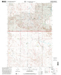
1998 Map of Lodgepole
USGS Topo · Published 2001About this map
The Grand River National Grassland dominates the northern half of this Perkins County landscape, where the high plains transition into the drainage of the Grand River. This late 20th-century survey illustrates a classic South Dakota rangeland economy defined by widely dispersed family operations such as the L Zimmerman Ranch, V Henderson Ranch, and B Smith Ranch. These named homesteads are anchored by the small community of Lodgepole, which serves as a local hub with its Lodgepole Sch and a nearby Cem.
Find a feature on this map
18 named features on this map. Tap any name to fly to it.
Don’t see what you’re looking for? This feature index may not catch every label — zoom into the map to look around manually.
Map Details
Editions of this 1998 Lodgepole Map
This is the sole edition of this map. No revisions or reprints were ever made.
Other maps of this area

1954 · Lemmon
USGS Topo · 1:250,000

1957 · Lemmon
USGS Topo · 1:250,000

1974 · Hettinger South
USGS Topo · 1:24,000

1974 · Cow Butte NE
USGS Topo · 1:24,000

1974 · Kid Rich Butte
USGS Topo · 1:24,000

1983 · Cow Butte SE
USGS Topo · 1:24,000

1983 · Lodgepole SE
USGS Topo · 1:24,000

1983 · Prairie City NE
USGS Topo · 1:24,000

1983 · Cole Dam
USGS Topo · 1:24,000

1983 · Little Nasty Creek
USGS Topo · 1:24,000