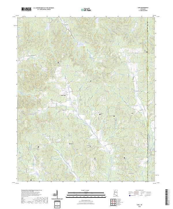
2024 Map of Lodi
USGS Topo · Published 2024About this map
The hills of Montgomery and Webster counties define this landscape, anchored by the rural settlements of Cedar Hill and Lodi. This modern survey reveals a countryside deeply connected to its family roots, with numerous cemeteries such as Shiloh Cem, Salem Cem, and Bronte Cem scattered across the township lines. The terrain is carved by the drainages of Mulberry Creek and Lodi Creek, where winding routes like Alvastage Rd and Harrison Rd follow the natural contours of the land. The presence of the Old Northern Grocery Cem near Minerva points to the area's former commercial hubs, now primarily characterized by woodland and small water bodies like Beat Three Lake. Researchers will find a clear record of the enduring road network and the family burial grounds that have served these hill-country communities for generations.
Find a feature on this map
52 named features on this map. Tap any name to fly to it.
Don’t see what you’re looking for? This feature index may not catch every label — zoom into the map to look around manually.
Map Details
Editions of this 2024 Lodi Map
This is the sole edition of this map. No revisions or reprints were ever made.
Other maps of this area

1953 · Walthall
USGS Topo · 1:62,500

1953 · West Point
USGS Topo · 1:250,000

1954 · Duck Hill
USGS Topo · 1:62,500

1958 · West Point
USGS Topo · 1:250,000

1963 · West Point
USGS Topo · 1:250,000

1966 · Kilmichael
USGS Topo · 1:24,000

1966 · Winona
USGS Topo · 1:24,000

1966 · Stewart
USGS Topo · 1:24,000

1968 · Weir
USGS Topo · 1:62,500

1968 · Winona
USGS Topo · 1:62,500