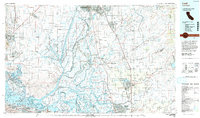
1993 Map of Lodi
USGS Topo · Published 1994About this map
The intricate waterways of the California Delta dominate this landscape, where the Sacramento River and San Joaquin River converge amidst a massive network of reclaimed land. Dozens of named tracts and islands, including Staten Island, Ryer Island, and Grand Island, illustrate the intensive hydraulic engineering and agricultural development that transformed this region. The map reveals the critical infrastructure of the era, from the Sacramento River Deep Water Ship Channel and the expansive Yolo Bypass to the heavy rail presence of the Southern Pacific and Sacramento Northern lines.
Find a feature on this map
271 named features on this map. Tap any name to fly to it.
Don’t see what you’re looking for? This feature index may not catch every label — zoom into the map to look around manually.
Map Details
Editions of this 1993 Lodi Map
2 editions found
Other maps of this area

1889 · Jackson
USGS Topo · 1:125,000

1891 · Sacramento
USGS Topo · 1:125,000

1891 · Placerville
USGS Topo · 1:125,000

1892 · Jackson
USGS Topo · 1:125,000

1892 · Sacramento
USGS Topo · 1:125,000

1892 · Placerville
USGS Topo · 1:125,000

1893 · Placerville
USGS Topo · 1:125,000

1893 · Sacramento
USGS Topo · 1:125,000

1894 · Lodi
USGS Topo · 1:125,000

1896 · Carquinez Strait
USGS Topo · 1:62,500