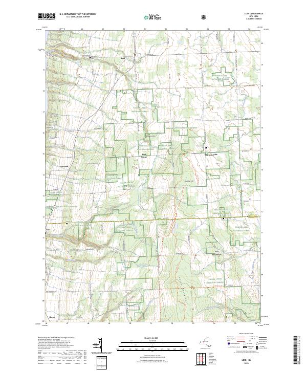
2023 Map of Lodi
USGS Topo · Published 2023About this map
Finger Lakes National Forest dominates this landscape in southern Seneca County, where the terrain transitions from the shores near Caywood up toward the high ridge of Hector Backbone. The settlement of Lodi serves as a primary hub, surrounded by a network of smaller hamlets including Townsendville and Lodi Center. The map reveals a deeply rooted rural history preserved in its burial grounds, from the West Lodi Cem near the northern border to the Cronk Cem further south.
Find a feature on this map
94 named features on this map. Tap any name to fly to it.
Don’t see what you’re looking for? This feature index may not catch every label — zoom into the map to look around manually.
Map Details
Editions of this 2023 Lodi Map
This is the sole edition of this map. No revisions or reprints were ever made.
Other maps of this area

1893 · Ithaca
USGS Topo · 1:62,500

1895 · Ithaca
USGS Topo · 1:62,500

1898 · Watkins Glen
USGS Topo · 1:62,500

1901 · Watkins
USGS Topo · 1:62,500

1902 · Genoa
USGS Topo · 1:62,500

1902 · Ovid
USGS Topo · 1:62,500

1905 · Watkins Glen
USGS Topo · 1:125,000

1942 · Ovid
USGS Topo · 1:31,680

1942 · Dundee
USGS Topo · 1:24,000

1942 · Lodi
USGS Topo · 1:24,000