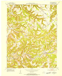
1953 Map of Lodiburg
USGS Topo · Published 1954About this map
Union Star and Lodiburg anchor this mid-century portrait of Breckinridge County, where the landscape is defined by the sharp transition from wooded ridges to the winding bottomlands of Sinking Creek. The Louisville and Nashville corridor cuts across the southern portion of the quadrangle, serving the small communities of Sample and Lodiburg. This era shows a rural network of family-named landmarks and local institutions, including the Frymire Sch and Dry Valley Ch.
Find a feature on this map
39 named features on this map. Tap any name to fly to it.
Don’t see what you’re looking for? This feature index may not catch every label — zoom into the map to look around manually.
Map Details
Editions of this 1953 Lodiburg Map
3 editions found
Other maps of this area

1928 · Hardinsburg
USGS Topo · 1:48,000

1931 · Hardinsburg
USGS Topo · 1:62,500

1934 · Cannelton
USGS Topo · 1:62,500

1947 · Irvington
USGS Topo · 1:24,000

1947 · Lodiburg
USGS Topo · 1:24,000

1947 · Hardinsburg
USGS Topo · 1:24,000

1947 · Garfield
USGS Topo · 1:24,000

1947 · Hardinsburg
USGS Topo · 1:62,500
1950 · New Amsterdam
USGS Topo · 1:24,000

1950 · Alton
USGS Topo · 1:62,500