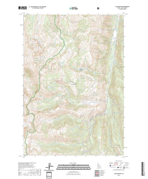
2024 Map of Log Mountain
USGS Topo · Published 2024About this map
Payette National Forest and Boise National Forest converge in this high-altitude landscape of central Idaho. The terrain is defined by prominent summits such as Log Mtn and Shell Rock Peak, with the notable massif of Thunder Mountain rising to the east. A complex network of drainage basins feeds into Johnson Creek, which flows northward through the eastern portion of the sheet. High-country meadows including Caton Meadow, Wardenhoff Meadows, and Round Meadow provide clearings within the timbered slopes. Evidence of recreational and historical access is visible through the Log Mountain Trl, Caton Lake Trl, and Rainbow Lake Trl, which connect the isolated Rainbow Lake and Shell Rock Lake to the surrounding drainage systems of Caton Creek and Ditch Creek.
Find a feature on this map
41 named features on this map. Tap any name to fly to it.
Don’t see what you’re looking for? This feature index may not catch every label — zoom into the map to look around manually.
Map Details
Editions of this 2024 Log Mountain Map
This is the sole edition of this map. No revisions or reprints were ever made.
Other maps of this area

1937 · Yellow Pine
USGS Topo · 1:48,000

1943 · Yellow Pine
USGS Topo · 1:62,500

1954 · Warm Lake
USGS Topo · 1:62,500

1957 · Challis
USGS Topo · 1:250,000

1960 · Challis
USGS Topo · 1:250,000

1961 · Chinook Mtn
USGS Topo · 1:62,500

1963 · Challis
USGS Topo · 1:250,000
1973 · Chilcoot Peak
USGS Topo · 1:24,000
1973 · Yellow Pine
USGS Topo · 1:24,000

1973 · White Rock Peak
USGS Topo · 1:24,000