
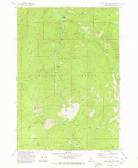
1973 Map of White Rock Peak
USGS Topo · Published 1976About this map
The South Fork Salmon River carves through a deep canyon corridor in this 1973 survey, acting as the primary artery for travel and recreation between the Payette National Forest and the Boise National Forest. The map documents a landscape defined by dramatic elevation changes, from the riverside flats where Poverty Flat Campground and Lodgepole Campground are situated, up to the high prominence of White Rock Peak. A single Pack Trail provides the primary overland access through the steep drainages of Blackmare Creek and Silver Creek. Of particular interest to those studying local hydrology is the isolated Spring (Hot) located near Goat Creek, suggesting the geothermal activity prevalent in this part of the Idaho batholith. The boundary between the two national forests is clearly delineated, following the high ridges that separate these vast timber and watershed reserves.
Find a feature on this map
22 named features on this map. Tap any name to fly to it.
Don’t see what you’re looking for? This feature index may not catch every label — zoom into the map to look around manually.
Map Details
Editions of this 1973 White Rock Peak Map
2 editions found
Other maps of this area

1954 · Gold Fork
USGS Topo · 1:62,500

1954 · Warm Lake
USGS Topo · 1:62,500

1957 · Challis
USGS Topo · 1:250,000

1960 · Challis
USGS Topo · 1:250,000

1963 · Challis
USGS Topo · 1:250,000

1973 · Blackmare
USGS Topo · 1:24,000
1973 · Log Mountain
USGS Topo · 1:24,000

1973 · Fitsum Peak
USGS Topo · 1:24,000
1973 · Caton Lake
USGS Topo · 1:24,000
1973 · Teapot Mtn
USGS Topo · 1:24,000