
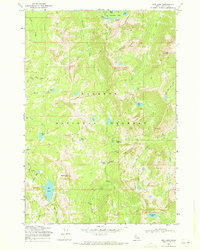
1973 Map of Fitsum Peak
USGS Topo · Published 1977About this map
Buckhorn Hot Spring sits near the southern edge of this high-elevation terrain, a remote thermal feature in the heart of the Payette National Forest. This 1973 survey illustrates a landscape defined by sharp elevation changes and high mountain basins, largely inaccessible except by the extensive network of Pack Trails and occasional Jeep Trails that traverse the ridges.
Find a feature on this map
24 named features on this map. Tap any name to fly to it.
Don’t see what you’re looking for? This feature index may not catch every label — zoom into the map to look around manually.
Map Details
Editions of this 1973 Fitsum Peak Map
This is the sole edition of this map. No revisions or reprints were ever made.
Other maps of this area

1956 · Elk City
USGS Topo · 1:250,000

1957 · Challis
USGS Topo · 1:250,000

1960 · Elk City
USGS Topo · 1:250,000

1960 · Challis
USGS Topo · 1:250,000

1963 · Challis
USGS Topo · 1:250,000

1969 · Enos Lake
USGS Topo · 1:24,000
1969 · Box Lake
USGS Topo · 1:24,000

1969 · Williams Peak
USGS Topo · 1:24,000

1973 · Blackmare
USGS Topo · 1:24,000

1973 · White Rock Peak
USGS Topo · 1:24,000