
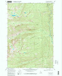
1969 Map of Enos Lake
USGS Topo · Published 1971About this map
Payette National Forest dominates this 1969 topographic study, characterized by high-altitude drainages and dramatic peaks like North Loon Mtn. The landscape is defined by the Secesh River and its intricate network of tributaries, including Lick Creek and Enos Creek. Higher elevations reveal a series of alpine water bodies, most notably Enos Lake, Jungle Lake, and Cow Lake, which are linked by a system of historical transit routes designated as Pack Trail. A high-vantage Lookout Tower sits at Split Creek Point, overlooking the junction of Split Creek and the river. This survey reflects the era of mid-century forest management and wilderness access in Valley County, before modern development altered these backcountry routes. The presence of numerous named drainages such as Maverick Creek, Calf Creek, and Cow Creek suggests a landscape historically utilized for seasonal grazing and early resource exploration.
Find a feature on this map
23 named features on this map. Tap any name to fly to it.
Don’t see what you’re looking for? This feature index may not catch every label — zoom into the map to look around manually.
Map Details
Editions of this 1969 Enos Lake Map
2 editions found
Other maps of this area

1956 · Elk City
USGS Topo · 1:250,000

1957 · Challis
USGS Topo · 1:250,000

1960 · Elk City
USGS Topo · 1:250,000

1960 · Challis
USGS Topo · 1:250,000

1963 · Challis
USGS Topo · 1:250,000

1969 · Loon Lake
USGS Topo · 1:24,000

1969 · Pony Meadows
USGS Topo · 1:24,000
1969 · Box Lake
USGS Topo · 1:24,000

1969 · Williams Peak
USGS Topo · 1:24,000
1969 · Victor Peak
USGS Topo · 1:24,000