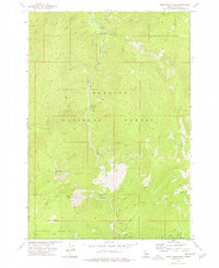
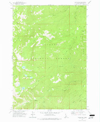
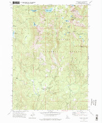
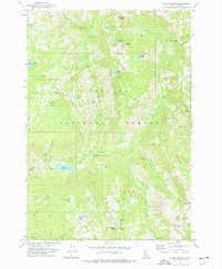
1973 Map of Blackmare
USGS Topo · Published 1976About this map
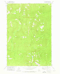
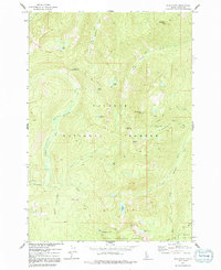
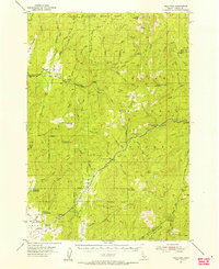
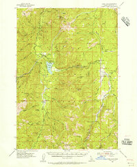
Payette National Forest and Boise National Forest meet across this 1973 high-country survey, characterized by a complex network of ridgelines and pack trails. The landscape is punctuated by vital fire observation points at Miners Peak Lookout and Blackmare Lookout, which overlook deep drainage basins carved by Buckhorn Creek and Blackmare Creek. High-altitude alpine features define the local geography, including Cougar Saddle and Needles Summit.
Find a feature on this map
30 named features on this map. Tap any name to fly to it.
Don’t see what you’re looking for? This feature index may not catch every label — zoom into the map to look around manually.
Map Details
Editions of this 1973 Blackmare Map
2 editions found
Other maps of this area
1954 · Gold Fork
USGS Topo · 1:62,500
1954 · Warm Lake
USGS Topo · 1:62,500

1957 · Challis
USGS Topo · 1:250,000

1960 · Challis
USGS Topo · 1:250,000

1963 · Challis
USGS Topo · 1:250,000
1973 · White Rock Peak
USGS Topo · 1:24,000
1973 · Fitsum Peak
USGS Topo · 1:24,000
1973 · Paddy Flat
USGS Topo · 1:24,000

1973 · Teapot Mtn
USGS Topo · 1:24,000
1973 · Fitsum Summit
USGS Topo · 1:24,000