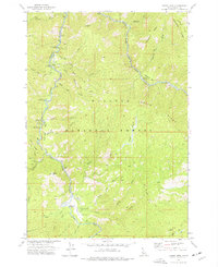
1973 Map of Teapot Mtn
USGS Topo · Published 1977About this map
The South Fork Salmon River carves a deep path through this portion of the Payette National Forest, dictating the location of forest infrastructure and recreational sites in the 1970s. The Krassel Ranger Sta and a nearby Gaging Station serve as central points for administration and monitoring along the waterway. Access to this backcountry terrain is facilitated by the Reed Ranch Landing Strip and another unnamed landing strip, which complement a network of trails such as the Sixmile Pack Trail and the Jakie Jeep Trail. Numerous campgrounds, including Krassel Creek Campground, Salmon Point Campground, and Buckhorn Campground, are situated on river bars and near creek confluences. Significant landmarks like Teapot Mtn, Eagle Rock, and Rainbow Ridge define the vertical relief, while a Radio Tower atop a high point marks the reach of mid-century communication technology.
Find a feature on this map
47 named features on this map. Tap any name to fly to it.
Don’t see what you’re looking for? This feature index may not catch every label — zoom into the map to look around manually.
Map Details
Editions of this 1973 Teapot Mtn Map
2 editions found
Other maps of this area

1956 · Elk City
USGS Topo · 1:250,000

1957 · Challis
USGS Topo · 1:250,000

1960 · Elk City
USGS Topo · 1:250,000

1960 · Challis
USGS Topo · 1:250,000

1963 · Challis
USGS Topo · 1:250,000

1969 · Enos Lake
USGS Topo · 1:24,000

1969 · Parks Peak
USGS Topo · 1:24,000

1969 · Williams Peak
USGS Topo · 1:24,000

1973 · Blackmare
USGS Topo · 1:24,000

1973 · White Rock Peak
USGS Topo · 1:24,000