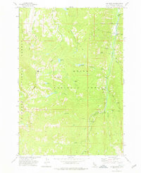
1973 Map of Log Mountain
USGS Topo · Published 1976About this map
Payette National Forest and Boise National Forest converge in this high-altitude landscape of central Idaho, centered on the prominent Log Mountain and Shell Rock Peak. The map documents a rugged wilderness terrain where 1970s land use was defined by pack trails and remote outpost sites rather than dense settlement. The eastern edge of the quadrangle follows the winding course of Johnson Creek, punctuated by geographic markers like Whitehorse Rapids and the Halfway Station (Site). Historically significant infrastructure is visible in the form of the Old Thunder Mtn Road, a route tied to the region's mining heritage. Small-scale ranching and temporary camps are represented by Cox Ranch and several named meadows, including Wardenhoff Meadows and Caton Meadow, which suggest a landscape utilized for seasonal grazing and high-country travel during the mid-20th century.
Find a feature on this map
34 named features on this map. Tap any name to fly to it.
Don’t see what you’re looking for? This feature index may not catch every label — zoom into the map to look around manually.
Map Details
Editions of this 1973 Log Mountain Map
2 editions found

Other maps of this area

1937 · Yellow Pine
USGS Topo · 1:48,000

1943 · Yellow Pine
USGS Topo · 1:62,500

1954 · Warm Lake
USGS Topo · 1:62,500

1957 · Challis
USGS Topo · 1:250,000

1960 · Challis
USGS Topo · 1:250,000

1961 · Chinook Mtn
USGS Topo · 1:62,500

1963 · Challis
USGS Topo · 1:250,000
1973 · Chilcoot Peak
USGS Topo · 1:24,000
1973 · Yellow Pine
USGS Topo · 1:24,000

1973 · White Rock Peak
USGS Topo · 1:24,000