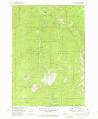
1973 Map of White Rock Peak
USGS Topo · Published 1980About this map
The South Fork Salmon River carves a deep path through this section of central Idaho, serving as a primary corridor for travel and recreation during the mid-1970s. The landscape is defined by its dramatic elevation changes, notably at White Rock Peak and along the steep reaches of Blackmare Ridge and Cougar Ridge. This terrain, shared between the Payette National Forest and Boise National Forest, was mapped primarily for wilderness management, emphasizing the primitive access routes that connect the riverbanks to the surrounding heights.
Find a feature on this map
28 named features on this map. Tap any name to fly to it.
Don’t see what you’re looking for? This feature index may not catch every label — zoom into the map to look around manually.
Map Details
Editions of this 1973 White Rock Peak Map
2 editions found
Other maps of this area

1954 · Gold Fork
USGS Topo · 1:62,500

1954 · Warm Lake
USGS Topo · 1:62,500

1957 · Challis
USGS Topo · 1:250,000

1960 · Challis
USGS Topo · 1:250,000

1963 · Challis
USGS Topo · 1:250,000

1973 · Blackmare
USGS Topo · 1:24,000

1973 · White Rock Peak
USGS Topo · 1:24,000
1973 · Log Mountain
USGS Topo · 1:24,000

1973 · Fitsum Peak
USGS Topo · 1:24,000
1973 · Caton Lake
USGS Topo · 1:24,000