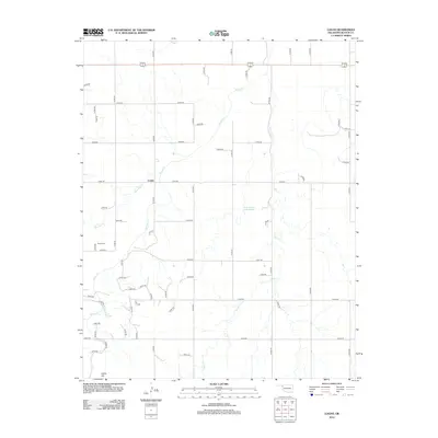
2012 Map of Logan
USGS Topo · Published 2012About this map
Logan sits at the heart of this Beaver County landscape, where the agricultural grid of the Oklahoma Panhandle meets the winding drainage of Kiowa Cr. The area is defined by a dense network of local section roads, such as N1560 Rd and E0300 Rd, which provide access to remote farmsteads and ranching lands. Just to the west of the main settlement lies the Kiowa Cem, a significant site for genealogists tracing the early pioneer families of the High Plains.
Find a feature on this map
55 named features on this map. Tap any name to fly to it.
Don’t see what you’re looking for? This feature index may not catch every label — zoom into the map to look around manually.
Map Details
Editions of this 2012 Logan Map
This is the sole edition of this map. No revisions or reprints were ever made.
Other maps of this area

1954 · Perryton
USGS Topo · 1:250,000

1958 · Perryton
USGS Topo · 1:250,000

1971 · Clear Lake
USGS Topo · 1:24,000

1971 · Clear Lake SE
USGS Topo · 1:24,000

1971 · Logan
USGS Topo · 1:24,000

1971 · Logan NW
USGS Topo · 1:24,000

1971 · Logan NE
USGS Topo · 1:24,000

1971 · Slapout
USGS Topo · 1:24,000
1972 · Magoun
USGS Topo · 1:24,000

1972 · Follett
USGS Topo · 1:24,000