
1971 Map of Logan NW
USGS Topo · Published 1973About this map
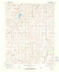
Evans Chambers Lake and its surrounding watershed define the topography of this corner of Beaver Co. in the early 1970s. The landscape is marked by the presence of numerous Gas Wells and Drill Holes, signaling the importance of energy extraction in the Oklahoma Panhandle during this era. Social life in this rural community appears centered around local landmarks like the Highland Chapel and the nearby Clear Lake Cem.
Find a feature on this map
14 named features on this map. Tap any name to fly to it.
Don’t see what you’re looking for? This feature index may not catch every label — zoom into the map to look around manually.
Map Details
Editions of this 1971 Logan NW Map
2 editions found
Other maps of this area

1954 · Perryton
USGS Topo · 1:250,000

1958 · Perryton
USGS Topo · 1:250,000

1970 · Knowles
USGS Topo · 1:24,000

1970 · Gate
USGS Topo · 1:24,000

1970 · Mocane SE
USGS Topo · 1:24,000

1971 · Clear Lake
USGS Topo · 1:24,000

1971 · Clear Lake SE
USGS Topo · 1:24,000

1971 · Logan
USGS Topo · 1:24,000

1971 · Logan NE
USGS Topo · 1:24,000

1971 · Slapout
USGS Topo · 1:24,000